RSSI is signal strength, not distance
RSSI is a received-power sample at the antenna. It is not a tape measure of how far a tag sits from that receiver.
What RSSI actually measures
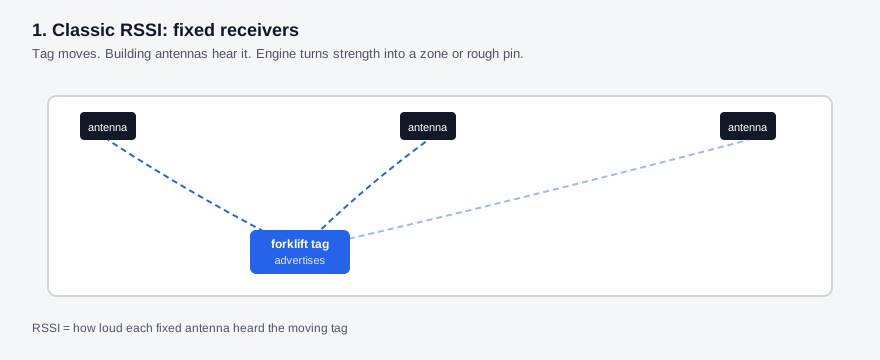
RSSI (Received Signal Strength Indicator) is how loud a radio packet sounds to the receiver, almost always reported in dBm. More negative means weaker. The value is power at the antenna for that packet, not meters (feet) on the floor. Indoor real-time location system (RTLS) stacks on Bluetooth Low Energy (BLE) and Wi-Fi often feed those samples into a location engine that guesses proximity or a rough coordinate. The guess rests on one idea: quieter usually means farther.
That idea needs a clear radio path and a fade rate that stays stable. Neither holds for long on a plant floor. The same loudness can mean about 1 m (3 ft) in an open aisle, or a much shorter true distance when metal, bodies, and antenna orientation sit in the path. Industrial indoor positioning work keeps landing on the same limit: RSSI alone is a weak meter stick once shelves, movers, and reflections enter the path.
How engines turn loudness into meters
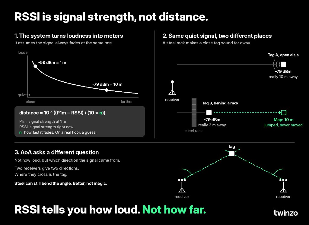
Location engines usually map RSSI through a path-loss model. In open space a louder reading near -59 dBm might map near 1 m (3 ft), and a quieter reading near -79 dBm might map near 10 m (33 ft). The formula still needs a calibrated reference at a known distance and a fade exponent, usually written as n. Free-space models often start near n = 2. Indoor halls with racking and stock commonly need a higher n, and that number shifts with aisle fill, WIP height, and people or vehicles that break line of sight.
So the map is not reading distance. It is reading loudness and converting it with assumptions. When the assumptions break, the reported location jumps even though the tagged asset stayed put. Filtering and averaging reduce packet-to-packet noise. They do not repair a wrong path-loss story.
Same quiet signal, two different places
Two tags can report the same RSSI and sit in different places. One tag may sit about 10 m (33 ft) away in an open aisle near -79 dBm. Another may sit only about 3 m (10 ft) away behind a steel rack face and still report about -79 dBm. An engine that treats loudness as distance places both at the farther distance. The second tag is still only about 3 m (10 ft) away. The map still reports it as if it sat in the open aisle.
Steel racks are the obvious blocker. A forklift crossing the line of sight, a person walking past the tag, a flipped antenna face, non-line-of-sight (NLOS) geometry, and multipath reflections do the same job: they change loudness without a true move. That is why RSSI-based BLE in metal halls often lands in a rough band around 3–10 m (10–33 ft) when teams are honest about the environment, as covered in BLE for RTLS.
Fine for zone presence, weak for bay identity
RSSI is often enough when the decision is zone presence: is the truck in this wing, past this gate, or still in the dock hall? Many search and fleet jobs only need that scale. It is a poor answer when the decision is which bay holds the cage, or whether the load sits on the exact floor mark. Medium-precision location for aisle and bay work in the 1–3 m (3–10 ft) band usually needs a cleaner method than raw loudness, or at least denser anchors and heavier filtering, and exact floor position in the sub-meter (~3 ft) band needs that cleaner method even more.
Match the radio method to the decision before you buy the equipment. That order sits under start with the decision, not the technology. The accuracy split is spelled out in zone presence vs medium-precision logistics track. The wider RTLS definition is in what is RTLS.
Direction finding asks a different question
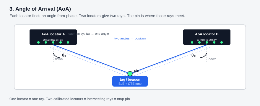
Other algorithms stop treating loudness as the main ruler. Angle of Arrival (AoA) asks which direction the packet came from. A multi-antenna receiver reads phase across its array. Two receivers give two directions. Where those directions cross is the estimated tag location. The measurement is geometry, not a single dBm number.
Steel can still bend the angle. Reflections create ghost directions. AoA is better for many bay-scale BLE jobs when arrays and line of sight hold. It is not a cure for every metal pocket. Inside the BLE family it sits beside classic and inverted RSSI builds as another location method, not a separate radio class. How those three BLE builds compare is in BLE for RTLS. How precision bands sit across technologies is in compare RTLS technologies.
How teams use the distinction on site
1. Name the floor question in meters (feet) - Zone presence, aisle or bay search, or exact floor position. Write the band before you buy a brochure accuracy number.
2. Treat unexplained map jumps as radio path change - Ask what blocked, reflected, or reoriented the path before you blame the driver or the twin.
3. Pick the method that answers the question - RSSI proximity for coarse presence. Direction finding or other ranging methods when bay identity matters for asset tracking or forklift tracking. Then land the stream on one hall view for internal logistics and production monitoring.
RSSI tells you how loud. Not how far. Get in touch if you want to test which location method matches the decisions on your own hall.